Housing Capacity BLI
Clatsop County, OR
Preparing Buildable Lands Inventories (BLI) for the county and each of the cities in compliance with state regulations.
About this Project
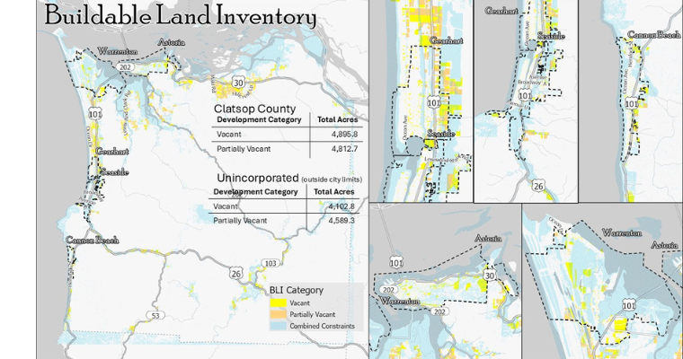
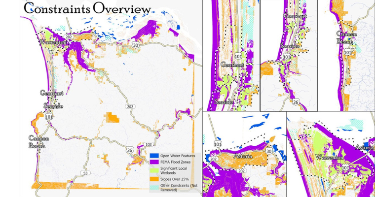
3J Consulting assisted Clatsop County with a multi-jurisdictional project to identify key housing production barriers for the cities and unincorporated rural communities of the county. 3J prepared Buildable Lands Inventories (BLIs) for the county and each of the cities in compliance with state regulations. The BLIs used local and regional zoning codes and environmental constraints to identify buildable residential lands across all participating jurisdictions.
3J used local and national datasets to perform the initial BLIs, which were then reviewed by the individual jurisdictions. The final work products included memorandums with findings tailored to each jurisdiction, giving Clatsop County and its cities a shared set of information about land, building, and infrastructure needs to guide future actions and investments.
Project Highlights
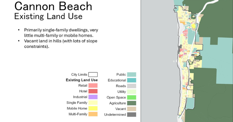
- Prepared Buildable Lands Inventories for Clatsop County and five cities: Astoria, Cannon Beach, Gearhart, Seaside, and Warrenton
- Mapped buildable lands, housing supply, and infrastructure constraints across all jurisdictions, including development status
- Applied local and regional zoning codes alongside environmental constraints to determine residential land buildability
- Leveraged local and national datasets to conduct initial BLI analysis, followed by jurisdiction-by-jurisdiction review and refinement
- Delivered jurisdiction-specific memorandums with tailored findings for each participating entity
- Created a shared information platform enabling coordinated decision-making on land, building, and infrastructure needs across Clatsop County
- Project funded by DLCD
-
Client
Clatsop County
-
Services
- GIS
- Planning